New data shows which Montreal streets are most pothole-prone
City filled 100,000 potholes since last December. Here are the streets that got the most attention
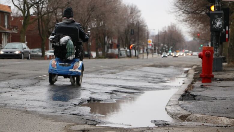
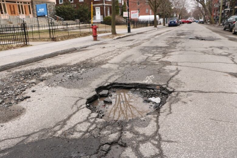
New data on potholes filled in the last four months by the City ofMontreal provides a window into the state of the city's main roads.
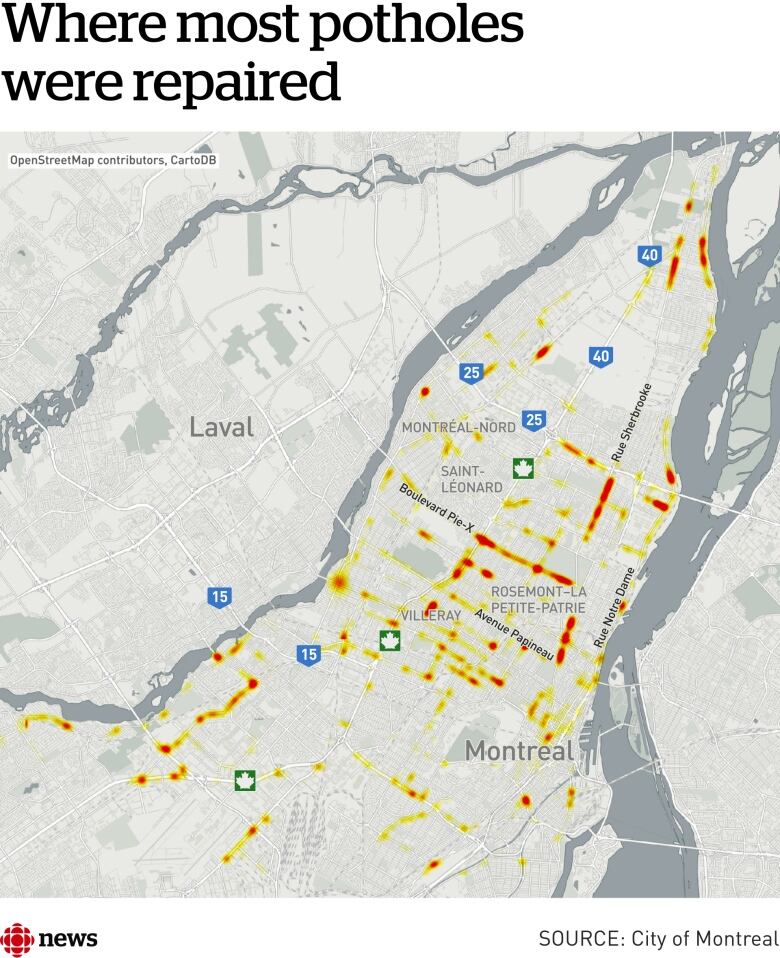
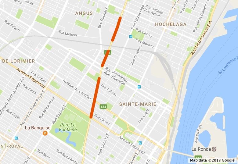
Mapping the nearly 100,000 pothole repairs on major arteries since Dec.1, 2016,has revealed a number of hotspots around the city.
Harout Chitilian, the city executive responsible for information technology, hailed the data release as further evidence of the administration's commitment to transparency.
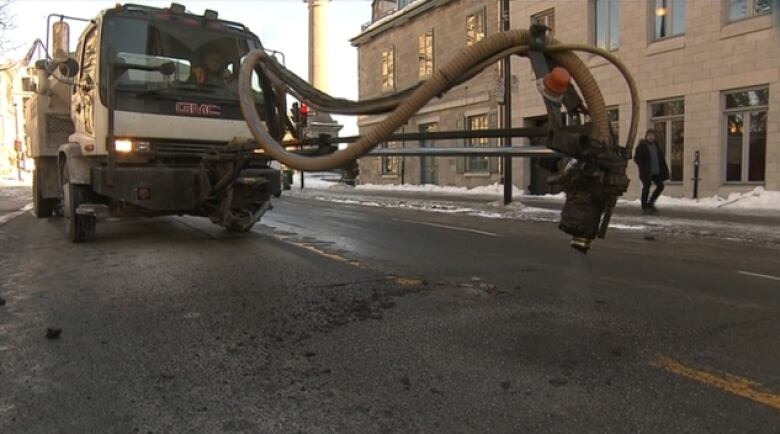
The data shows potholes repaired since Dec. 1, 2016,and comes from 10 GPS-equipped trucks that are dedicated to the task. The data released only coversmain arteries. Other streets are the responsibility of the city's 19 boroughs.
"The GPS data provides us with a detailed understanding of the state of the city's 4,050 kilometres of roads," Chitilian said.
While welcoming the improved transparency, the opposition Projet Montralquestioned the logic of patching and repatching the same holes.
"We're patching the same areas because the asphalt isn't sticking and the roads themselves need to be reconstructed," said Projet Montral transportation critic, Craig Sauv.
"That in conjunction with the fact we know Montreal pays two to three times what other big cities in Canada pay [for pothole repairs]."
Sauv said he hopes the data will allow citizens to push for real improvements to roads around the city.
"These data initiatives give us more artillery, more things to look at, more opportunities to analyze and to propose, and that's a good thing," he said.
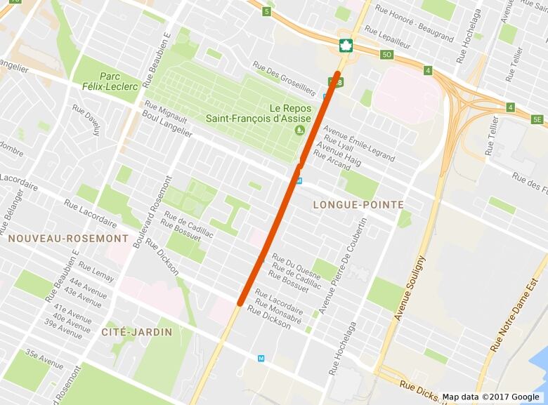
Sherbrooke Street East betweendu TrianonStreet and de l'Assomption Boulevard
- Segment length: 2,100 metres.
- Holes filled: 3,140.
Sherbrooke Street East between Saint-Germain Street and Papineau Avenue
- Segment length: 1,500 metres.
- Holes filled: 2,100.
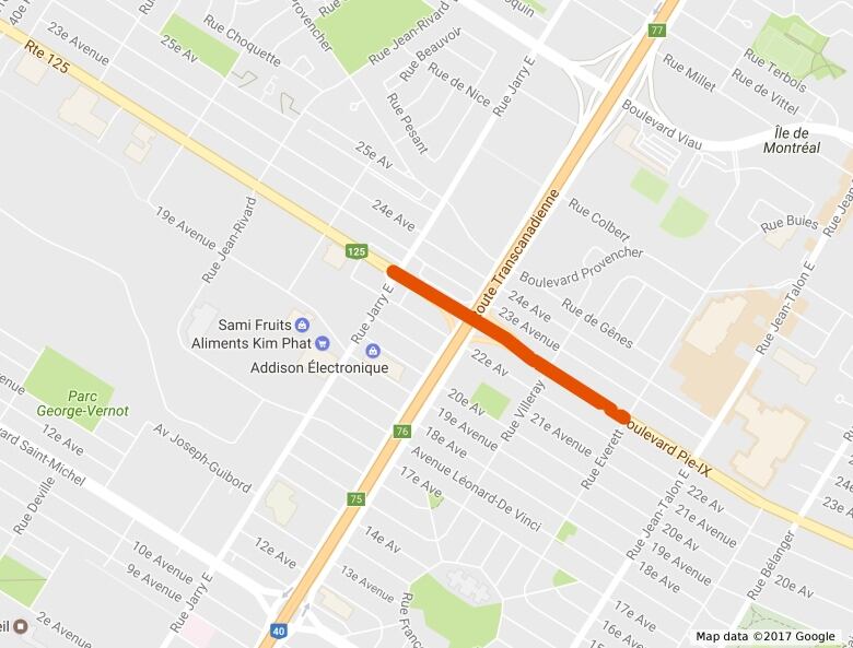
Pie-IX Boulevard between JarryStreet East and Everett Street
- Segment length: 820 metres.
- Holes filled: 1,340.
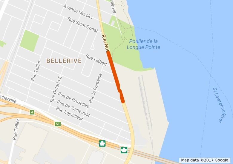
Notre-Dame Street East between De Beaurivage Street andLibertStreet
- Segment length: 450 metres.
- Holes filled: 840.
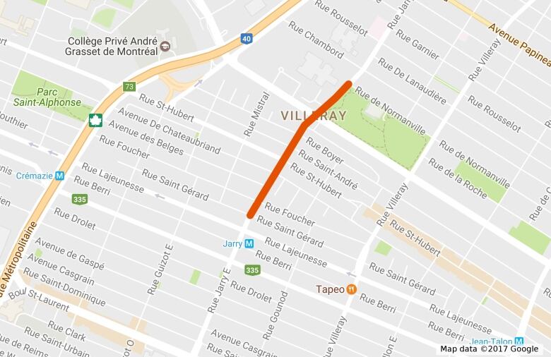
Jarry Street East between de Normanville Steet and Saint-Grard Street
- Segment length: 700 metres.
- Holes filled: 830.


_(720p).jpg)


 OFFICIAL HD MUSIC VIDEO.jpg)
.jpg)


