New Brunswick calls in coast guard to help flood relief effort
Communities in the southern part of the province will see rising water levels until next week
Latest
- The Trans-Canada Highway between Fredericton and Moncton will be closed to traffic Thursday night
- Southern water levels will continue to rise for next five days
- Coast guard to assist with flood relief effort
- Floodwaters in Saint John region will approach six metres, an all-time high
New Brunswick has enlisted the help of the Canadian Coast Guard as the province endures the worst spring flood in more than 80 years, Premier Brian Gallant announced Thursday.
The coast guard and the New Brunswick Emergency Measures Organizationwill soon determine the details of its involvement, the premier said on the seventh day of severe flooding in the province.
Gallant said they should have coast guard personnel by "the end of the day."
"It is clear that due to flooding there will be houses and families isolated. We will be managing a long and complex event, and we will need to support New Brunswickers in many ways," said Gallant during a press conference in Fredericton.
"We are therefore taking steps to increase our capability for marine operations."

As evacuations continue along the lower basin of the St. John River, emergency officials warned residents that the water levels will surpass record highs in many areas, and they're expected to continue rising for at least five days.
Officials continue to urge anyone in communities such as Grand Lake, Jemseg, Gagetown, Hampstead, Belleisle, Oak Point, Grand Bay-Westfield, Quispamsis and Saint John to be on high alert.
Gallant again urged residents to evacuate while they still can.
On Thursday, Red Cross officials said 388 people from 157 homes across the province have received assistance.
The province launched a disaster financial assistance program, which will aid individuals, small businesses and municipalities that suffered property damage from flooding.
Levels in Saint John could peak Monday
The five-day outlook along the river's southern reaches suggests the water could hit levels never seen beforewithin 72 hours.
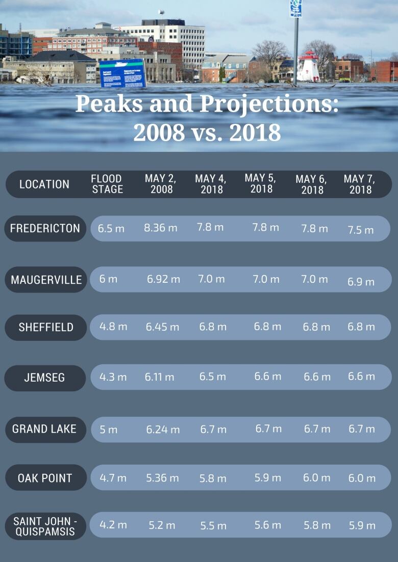
Saint John reached the 1973 high mark of 5.4 metres during high tide early Thursday morning. The level is expected to peak at 5.9 metres on Monday.
CHART: At high tide last night around 2:30am, the city of Saint John recorded its highest ever flood level. (Source: Environment Canada)
And the water is still rising. pic.twitter.com/Goc1mrayqI
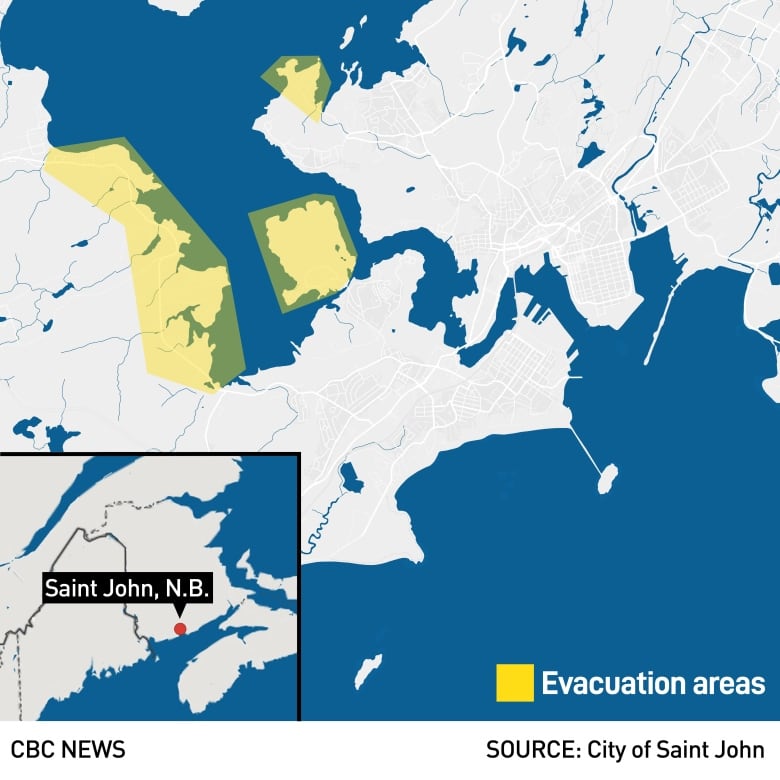
—@Brett_CBCThe city is urging more than 2,000 residents to leave their homes about 1,400 of those residents live in the Westfield Road area, which has been isolated by floodwaters.
NB Southern Railway is offering a free one-way rail shuttle for Westfield Road area residents starting at 4 p.m. AT on Thursday.
The record upriver in Oak Point, also from 1973, is 5.74 metres. The river is expected to rise to 5.8 metres Friday and six metres by Sunday.
Maugerville is projected to approach its all-time level of 7.11 metres by Friday, hovering around seven metres, and the Sheffield level has already passed the record mark of 6.45 metres and will rise and hold at 6.8 metres until Tuesday.
Water levels in Jemseg and the Grand Lake area are expected to remain stable, but well above flood stage, about 6.6 metres and 6.7 metres, respectively, for the next five days.
Water levels in Fredericton will remain around the eight-metre mark for the 72 hours and start to decline.
Tales from the flood
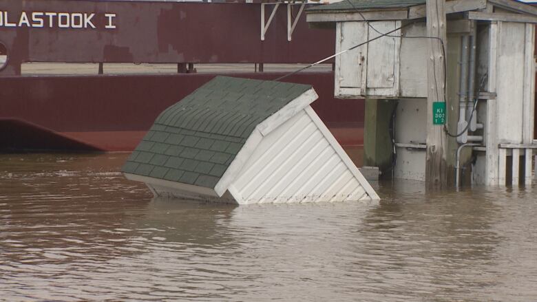
The rapid rise of the river is threatening to cut off the village ofGagetownfrom the rest of the province. Resident Valerie Smith said Thursday afternoon the water level is steadily going up, overwhelming the efforts ofproperty owners.
"They've been resilient in trying to prevent water from coming into their houses, but after a while the river wins out," she said.
"So a lot of businesses on Front Street have just decided to let it come in, because it's futile to try to keep it back."
In Fredericton, resident Mike Wright said he was pleased to see just five feet of water in his basement on Thursday. He and his neighbours have endured fluctuating floodwaters for a week, seeing it rise as high as seven feet in some homes.
In Rothesay, just east of Saint John, municipal trucks rushed to dump load after load of dirt to protect the lone road out of the KennebecasisPark subdivision. The historic water levels could leave about 300 homes and a school stranded.
Sandbagging detail: Grade five students @westfield_elem at Keel sand and gravel pit. Organizer Brittany Merrifield @kit17 "Either you show up here or message me on Facebook and we can arrange for trucks to get you where you need to go." pic.twitter.com/cd2pZ90Muw
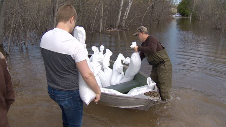
—@CaveRachelIn Grand Bay-Westfield, volunteers have been tirelessly filling sandbags for three days. Among the volunteers were Grade 5 students. The operation delivered 10,000 sandbags on Wednesday and23,000 more are on order.
Unhelpful weather
A combination of rain and rising temperatures means southern parts of New Brunswick are still at risk of record-setting water levels that have caused severe flooding in recent days.
"The hotter it is, the faster the snow is going to melt," said Geoffrey Downey, a spokesperson for New Brunswick's Emergency Measures Organization.

While Environment Canada ended its special weather statement overnight that saw rain across the province, some areas had record-breaking temperatures.
Downey said that in St. Stephen, a town west of Saint John, temperatures hit 29 C; the old record was 28.5 C.
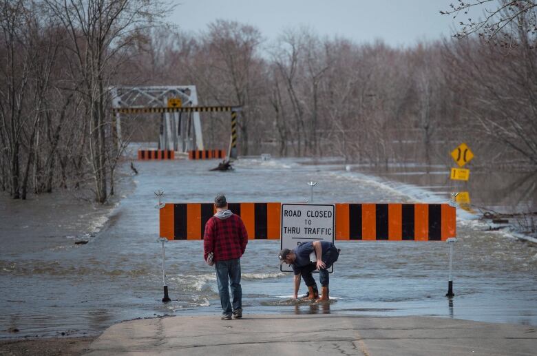
Road, ferry closures
Floodwaters have forced the closure of the Trans-Canada Highway between Fredericton and Monctonon Thursday.
The highway could stay closed for several days, said Ahmed Dassouki, director of operations with the Department of Transportation and Infrastructure.
"It's impossible to say how long the detour will be in place. At this time, we're just waiting for the water levels to recede," Dassouki said.
"It's in the best interest of public safety, and that's our main priority now."
Motorists will be detoured to Route 1 at River Glade and to Route 7 at Oromocto.
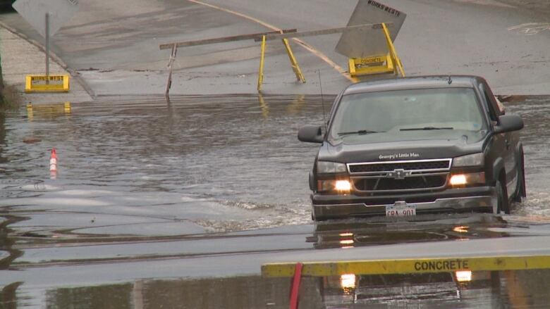
Dassouki said more than 140 provincial roads, bridges and culverts have been affected by flooding, including 81 road closures. That number is expected to rise.
All but one of the province's river ferries ceased operating Thursday,the exception being Gondola Point crossing in Quispamsis.


_(720p).jpg)


 OFFICIAL HD MUSIC VIDEO.jpg)
.jpg)


