Mother Nature delivers winter storm tonight with up to 45 cm of snow
Environment Canada has issued a winter storm warning for N.B. with 20 to 30 cm of snow expected in most areas
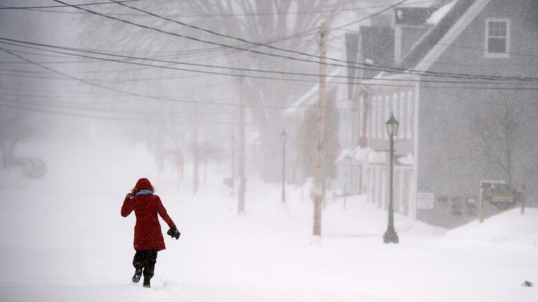
Spring is less than a week away but you won't know it when you look out the window tonight. A winter storm is expected to wallop New Brunswick with heavy snow, strong winds and ice pellets overnight.
Tuesday will start off calm with sunny skies howeverBrennan Allen, CBC's meteorologist,says it won't last.
"Clouds associated with our next major storm will encompass the entire region by late in the afternoon, pushing from southwest to northeast," he said.
Snow is expected to begin in southwest New Brunswick late in the afternoon with snow and blowing snow affecting all areas before midnight.
Environment Canada has issued a winter storm warning for the entire province with "rapidly accumulating snow and blowing snow beginning this evening."
"The snow will change to rain over southern and eastern regions overnight tonight into Wednesday morning and a few hours of ice pellets or freezing rain is likely during the precipitation changeover," according to the national weather service.
"Most of the province will receive snowfall amounts of 20 to 30 centimetres."
Environment Canada advises postponing non-essential travel as strong northeasterly winds gusting up to 90 kilometres per hour will cause blowing snow and reduced visibility.
In the southern half of New Brunswick the snow will turn to light showers by Wednesday morning.
"Elsewhere across New Brunswick to the north and northwest of Fredericton the precipitation should stay predominantly snow," Allen said.
"This portion of New Brunswick will see 30 to 45 centimetres of snow with strong northeasterly winds that will become lighter Wednesday morning."
Light snow and blustery winds are expected to linger on Wednesday.
New Brunswick forecast
Northern New Brunswick
Today: Expect a mix of sun and cloud with increasing cloudiness with flurries late in the afternoon. Winds will be from the northeast at 20 km/h, gusting to 40 km/h with a high near4 C.
Tonight: Snow and blowing snow mixed with ice pellets at timeswith accumulations between 30 and 45 cm. Winds will be from the northeast at 50 km/h, gusting to 80 km/h, then becoming southeast at 20 km/h, gusting to 40 km/h. The temperature will rise to 2 C by morning.
Wednesday: It will be mostly cloudy with light snow or flurries and a high near 0 C.
Fredericton and area
Today: Expect increasing cloudiness with snow beginning late in the afternoon. Winds will be from the northeast at 20 km/h, gusting to40 km/h with a high near 2 C.
Tonight: Snow and blowing snow mixed at times with ice pellets will change to showers by morning. Snowfall accumulations of 30 cm are expected along with rainfall accumulations of 2 mm. Winds will be from the east at 30 km/h, gusting to 50 km/h with the temperature rising to 0 C by morning.
Wednesday: It will be partly cloudy with a chance of showers or flurries and a high near 1 C.
Southern New Brunswick
Today: A mix of sun and cloud then increasing cloudiness with flurries in the southeast, snow and blowing snow in the southwest late in the afternoon. Winds will be from the east at 30 km/h, gusting to 50 km/h with a high near1 C.
Tonight: Expect snow and blowing snow, changing to showers by morning. Snowfall accumulations will be between 20 cm and 30 cm along with rainfall accumulations between2 mm and5 mm. Winds will be from the east at 50 km/h, gusting to 80 km/h except along the Fundy coast where gusts could reach 100 km/h. Later winds will become southeast at 30 km/h, gusting to 50 km/h with the temperature rising to 4 C overnight and then falling.
Wednesday: It will be partly cloudy with a chance of showers or flurries and a high near 2 C.


_(720p).jpg)


 OFFICIAL HD MUSIC VIDEO.jpg)
.jpg)


