How a new tool can predict coastal flooding in Nova Scotia down to the metre
Project aims to give emergency officials precise information so they can plan up to 10 days ahead of time
The developers of a made-in-Nova Scotia web tool say it canpredict the flow of coastal flooding right down the metre, precise information that will give provincial emergency officials days to prepare for incoming seawater from storm surges.
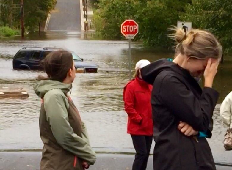
As concerns increase about flooding along the province's shoreline, and billions have already been spent dealing with similar problems on theU.S. Eastern Seaboard, agroup at the Nova Scotia Community College has researched a way to betterprevent damage and save lives.
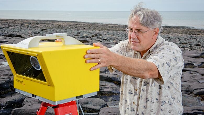
A big part of the solution is to more accurately predict flood pathways usingan online mapping tool, something Tim Webster in NSCC'sApplied GeomaticsResearch Group in the Annapolis Valleyhas been working on for more than a year and a half.
"We're in our final stage of tweaking and wrapping it up now," he said.
10 days of advanced warning
Advanced notice would give emergency plannersup to 10 daysto decide precisely where roads should be closed and to develop specific evacuation plans.
The issue right now, Webster said, is Nova Scotia's Emergency Management Office receives imprecise information from Environment Canada, which makes planning more difficult.
"Typically a very broad-scale map with big circles on it that say, 'Predicting storm surge along the eastern coast. High surf could cause flooding and a storm surge may causeflooding.' That's it," said Webster.
'Unprecedented detail'
Webster'steam usesa light detection and ranging (LIDAR) sensor on board an aircraft to get"unprecedenteddetail"of the coastline and tidal region beyond the coastline for high-risk coastal flooding areas.
There's LIDAR data for the Halifax Regional Municipality, the MinasBasin,Lunenburg, Yarmouth, Amherst, Pugwash, Antigonish, the Sydney area, communities in New Brunswick along the Northumberland Strait and the coastal Charlottetown area on P.E.I.
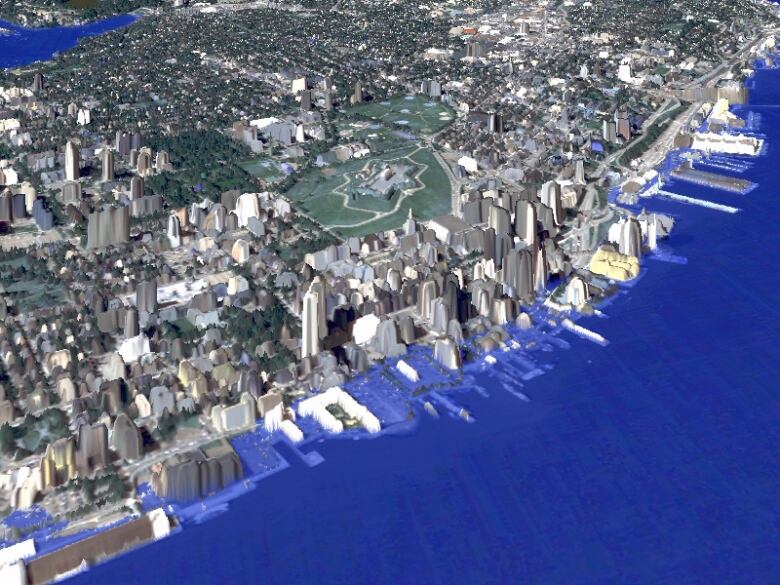
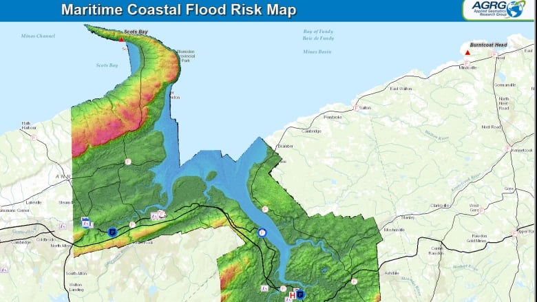
That information is then combined with tidal data and storm surge predictions from Environment Canadaplugged into Webster's software, giving an extremely accurate prediction of the path of floodwaters.
The toolpredictswhat parts of the coast may be inundated, including which roads and emergency depot locations such as fire, ambulance, and hospitals may be affected.
The system will launchMarch 31 as a tool for the Emergency Management Officeand other government officials.
Sea level rise predictions due to climate change
The tool also has implications for predicting sea level rise as a result of climate change, said Webster, even decades down the road.
"Town planners could look at, 'Well, we're building some infrastructure, where are we planning to build it?' Does that flood now? What about in 50 years time, would it flood? What about in 100 years time?" said Webster.
The National Oceanographic and Atmospheric Administration released a report earlier this year predicting oceanscouldrise by as much as 2 metresby the year 2100.
Currently, the software is only being used to predict the impact of coastal flooding. Webster said the tool could also be adapted tocomplicated river patterns in an effort to predict floods such as thosein Cape Breton last Thanksgiving, Truro in 2012 and Alberta in 2013.
"This type of system could be built for inland flooding, as well, but it's typically a more complicated problem and one needs to have more information to do such a prediction system," he said. "But it is possible if we had the information."
The project is funded bythe Canadian Safety and Security Program, a federally funded program led by Defence Research and Development Canada's Centre for Security Science,in partnership with Public Safety Canada. Itis locally managed by the Nova Scotia Department of Natural Resources.


_(720p).jpg)


 OFFICIAL HD MUSIC VIDEO.jpg)
.jpg)


