Halifax to study Sackville River watershed flooding risk
Beaver Bank, Bedford, Hammonds Plains, Lucasville, Mount Uniacke and Sackville identified as at-risk
Halifax wantsto hire engineers to study and map the SackvilleRiver in an effort to mitigate the risk of flooding, a problem the cityexpects will escalateas a result of climate change.
On Thursday, the city issued a tender for engineers to look into the issue. The area to be studied is about 150 square kilometres and includesthe sub-watershed of the Little Sackville River.
At-risk communities identified in the tender documentinclude Beaver Bank, Bedford, Hammonds Plains, Lucasville, Mount Uniacke and Sackville, which have become more urbanin recent years.
The project aims to develop models to show the impact of different magnitude storms,said Cameron Deacoff, the city'sproject manager for the work.
"The impacts of climate change also render the results of previous models less and less reliable," he said.
Flood factors
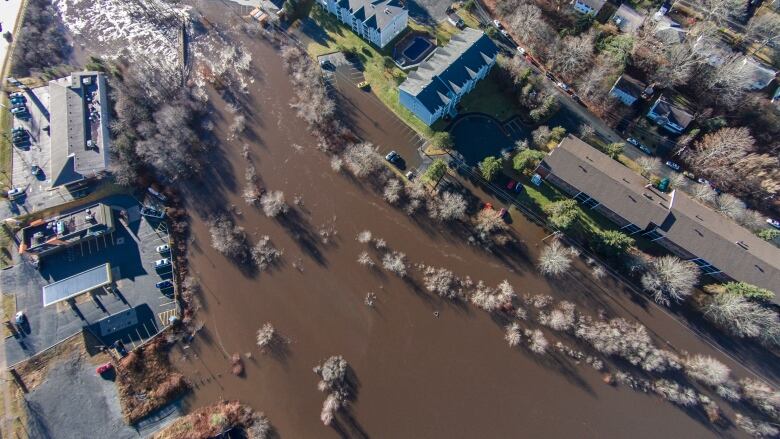
Flooding is getting worse, Deacoff said.
A bad winter stormleft manystreets and roads inBedford under waterin December 2014. Just four months later, water levels rose 2.6 metres after heavy rains.
The Sackville and Little Sackville rivers havebeen studied separatelysince 1987.In 1998, researchprovided an updated boundary of the flood plain based on residential and commercial developments.
Deacoff saidit'stime for new data, but that's not the only reason to renew the work.
"The SackvilleBusiness Association directly asked the municipality to update the mapping for the flood plain," he said.
"In response to that question, the municipality decided it was even more prudent to update the mapping for both the Little and the main Sackville Riverwatersheds on the basis of current data."
Phase 2 of 2
Thisis Phase 2. Phase 1,which analyzed riverflow, sea level data and flooding factors,was completed in October 2015.
Data from Phase 1 will be used by engineers to create several models of the Sackville River's water cycle and behaviour.
Deacoff said it's also important to clearlyunderstanding howclimate events that have become more frequent affect the watershed.
What used to be considered a once-in-a-100-year eventhas become more frequent, which is why the city is seekinga 500-year water cycle forecast for the area.
The tender closes Feb. 18 and work is expected to start in April, Deacoff said.The results of the study will eventually be made public through consultation in the fall.
The cost of the work won't be known until the city has found its engineers, but Deacoff said it will be "in the several tens of thousands of dollars, for certain."


_(720p).jpg)


 OFFICIAL HD MUSIC VIDEO.jpg)
.jpg)


