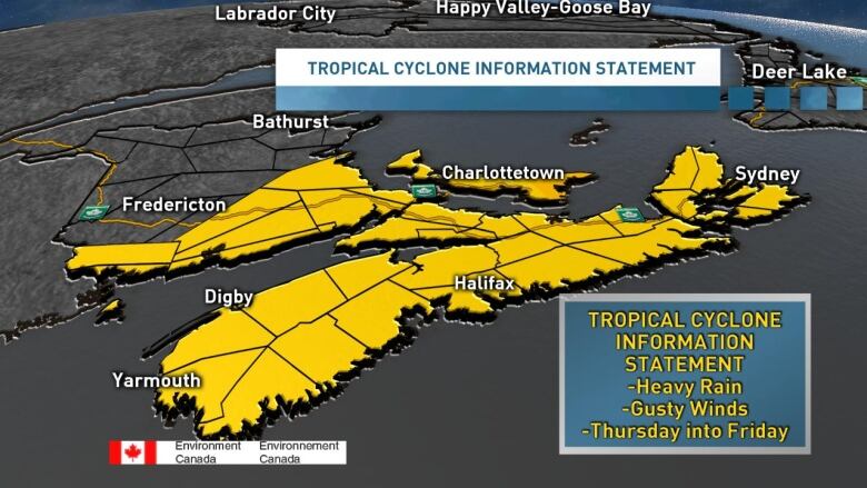
Heavy rain, gusty winds expected as tropical storm approaches Maritimes
Parts of the Maritimes could see at least 50 mm of rain in 12 hours on Thursday and into Friday
It's been a quiet start to the 2019 Atlantic hurricane season, but things are now turning active in the tropics.
We currently have two storms to keep an eye on, tropical storm Dorian, which at the moment poses no imminent threat to the Maritimes, and tropical depression six.
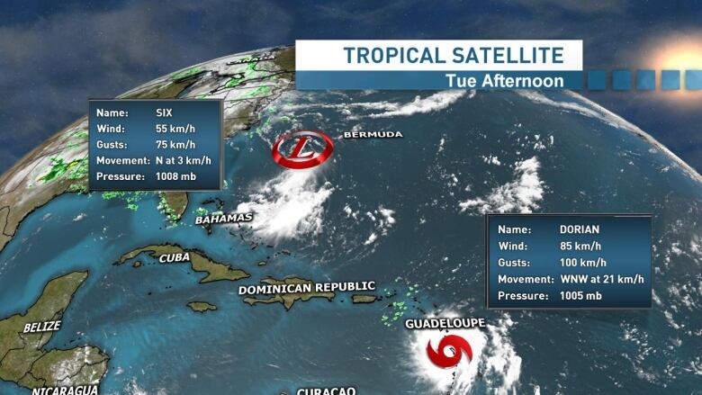
Tropical depression six is certainly a storm we'll need to watch carefully over the next couple of days. The system is expected to strengthen into a tropical storm and officially become Erin later Tuesday or Wednesday, before eventually becoming an extra-tropical storm as it tracks into our region on Thursday.
However, whether it officially becomes tropical storm Erin, this system is looking likely to impact the Maritimes later Thursday and into early Friday with some heavy rain and gusty winds.
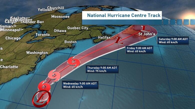
There is still plenty of uncertainty with this system and so staying tuned to the forecast over the next 48 hours will be important. However, here is what the system currently looks set to bring to the region.
Rainfall
Based on the current projections, the biggest impact on the Maritimes will be rainfall. While it's too early to say exactly how much rain will fall, parts of Nova Scotia, New Brunswick and P.E.I. could see more than 50 millimetresof rain in just 12 hours. Locally, amounts could top 70 to 100 millimetres. While we desperately need the rain, this amount of rain over such a short period of time will certainly bring the risk for localized flash flooding.
Wind
The strongest winds with these types of storms are found near and to the right of the track. As of now, the centre of the storm is expected to track just offshore, which would keep those strongest winds out over the water. That said, we could still see some wind gusts here on land typical of a fall nor'easter and some isolated power outages are possible.
Storm surges
With the current track and expected strength of the system, storm surges don't appear to be a big threat at this point. However, we'll also be keeping a close eye on this potential impact over the next day or so.
Be prepared
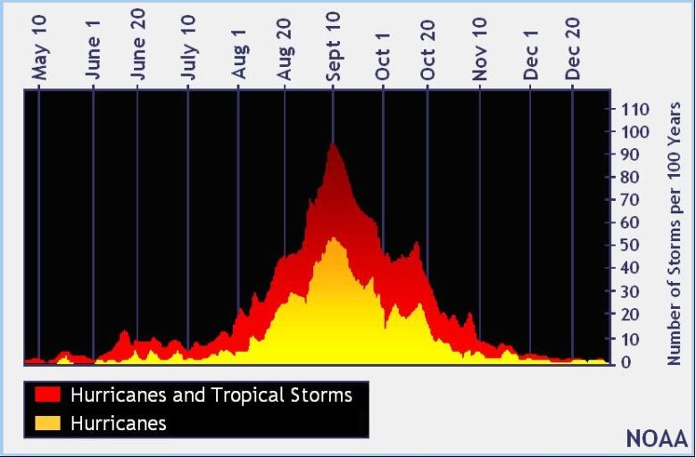
With a localized flooding risk and power outagespossible, now is a good time to make sure you have your home emergency kits ready to go. If not for this storm, then perhaps you might need it for the next one. We are now entering the peak of the Atlantic hurricane season, which continues through the month of September and into October.
Again, with this storm evolving quickly, the forecasts will be changing as well. The latest updated information can be found in my live blog below and I'll of course have another update this evening at 6 p.m. on the television newscast.
Follow the live blog
Keep up to date with our weather blog, updated every day.


_(720p).jpg)


 OFFICIAL HD MUSIC VIDEO.jpg)
.jpg)


