Increasingly powerful storms threaten Ottawa's tree cover
Resilient canopy needed as climate change takes root, foresters and advocates say
The City of Ottawa wants 40 per cent of its landscovered by trees in the future, according to the new official plan up from 31 per cent in 2017.
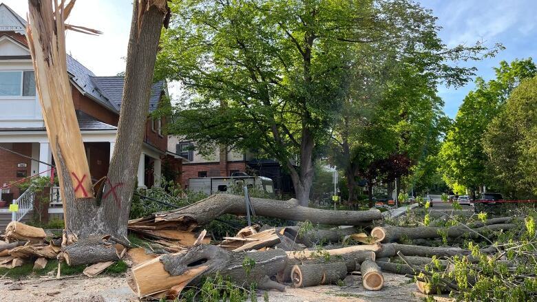
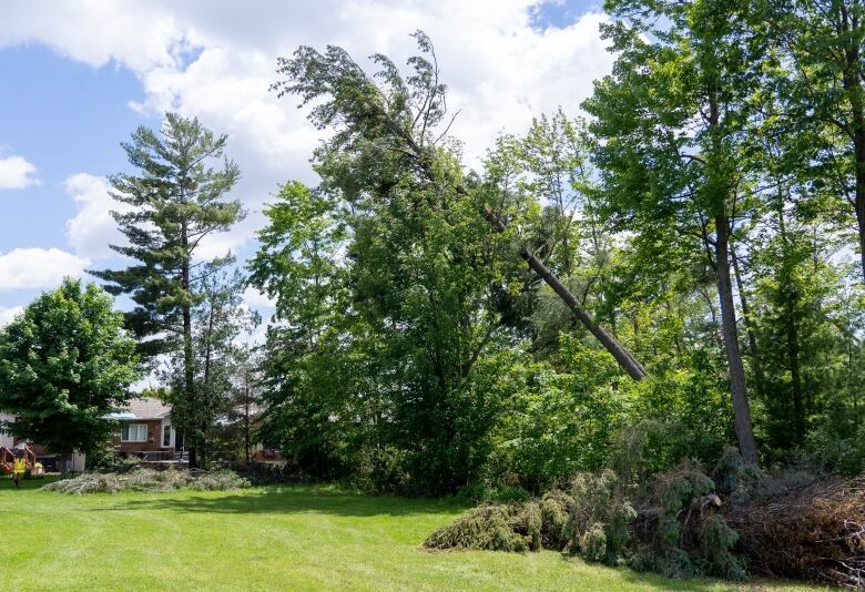
But after the May derecho and 2018 tornadoes destroyed many thousands of trees in the area, it's unclear just how soon that canbe achieved.
As efforts to repair thecanopy take shape in the coming weeks and months and as climate change conjures increasingly powerful and frequent storms, a more resilient tree canopy is needed to better stand up to them, forestersand green space advocates say.
A detailedpicture of the damage hasn't yet emerged as cleanup continues after this latest storm, but it won't be too much longer beforeone materializes.
A major tree canopy assessmentfor the entire National Capital Region was donein 2017,producinga highly detailedinteractive map of the canopy as it existed that year (the results were made public in 2019).
It showed that 31 per cent of Ottawa was covered in trees, compared to 45 per cent of Gatineau and 76 per cent of National Capital Commission (NCC)lands in and around both cities (NCC-controlled land is not included in the Ottawa and Gatineau figures).
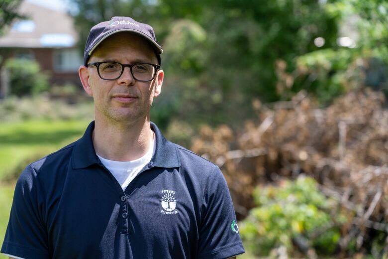
It just so happens that the next detailed assessment they're being done every five yearsis scheduled to begin this month, withflightsas long as the weather co-operates, according to Jason Pollard, a section manager for Ottawa's forestry department.
It'll take months to collect and process the data (a combination of aerial imagery and lidar data that reflects everything on the Earth's surface), but when it's finishedit'll show us just how destructive thederecho and tornadoes were across the region, amongother changes.
Some neighbourhoods lost many trees
The City of Ottawa covers a vast areaand an overalldrop in tree canopy of even one per cent would represent "a massive number" of destroyedtrees, saidPaul Johanis, chair of the Greenspace Alliance of Canada's Capital.
The organization pushes the municipality to protect and expand the city's tree cover.
But zooming into examine hard-hit areas, Johanis said neighbourhoods that had about 50 per cent tree covermay see itreduced by as much as 20 per cent.
"I think that we will see very measurable impacts because ata neighbourhood level, it really did have a big impact for those that were very much affected by the derecho," Johanis said.
"Clearly, this is unprecedented. I don't think we've seen anything like this before in terms of damage."

Pollard called the derecho "the most significant weather-related forest disturbance in decades," with damage varying in intensityin every neighbourhood.
Some of the areas hit hardest already had little existing tree canopy, according to the 2017 canopyassessment, which allowsresidents to look uptree canopy percentages specific to their neighbourhoods.
Only 15 per cent of Navan and Sarsfield werecovered with treesin 2017, for example, and Stittsville had a canopy of just 21 per cent.
Blossom Park, Merivale Gardens and the Greenbelt werealso hit hard. Theyboasted some of the densest tree cover in the city at about 44,52 and 40 per cent, respectively and may see those figuresreduced.

Researchers expand EF2 downburstdamage zone
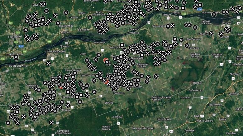
Meanwhile, researchers with Western University's Northern Tornadoes Project have continued assessing damage in and around Ottawa since the derechoand havefound thatwinds consistent with an EF2 tornadocaused damage along amuch longer path thaninitially thought.
While no tornadoes touched down in the city, an EF2downburst with winds reaching an estimatedpeak of about 190 km/hstruck in the southeastalong a path now believed to be about 36 kilometres long and five kilometres wide.

The intermittent EF2 downburst damage zone starts just east of the Ottawaairport around Blossom Park,continues east through rural Navan and Sarsfield,and ends past thecommunity of Hammond in neighbouring Clarence-Rockland, Ont.
Damage includes paths with most trees snapped or uprooted, farm outbuildings and silos demolishedand broken hydro poles.
Researchers also logged intermittent EF0 (104-137 km/h) and EF1 (138-177 km/h)damage across a much wider swath of eastern Ontarioand western Quebec.
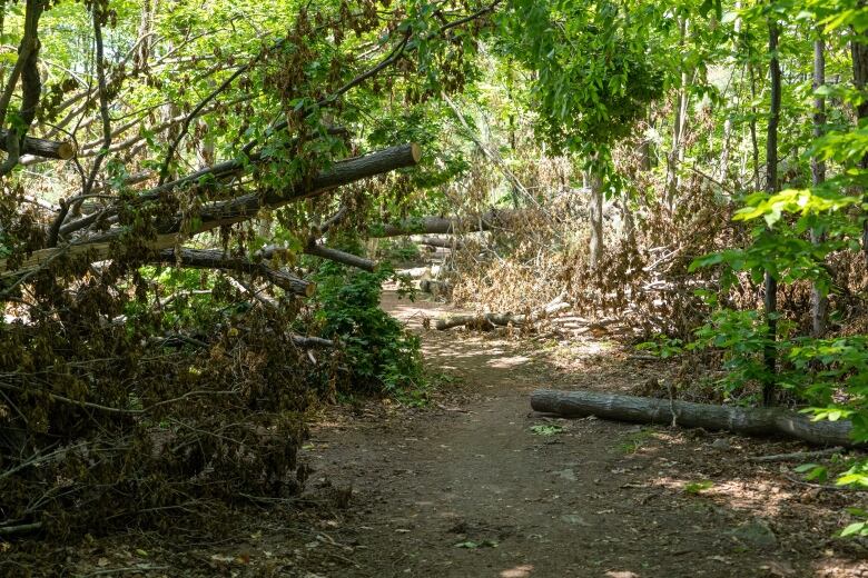
They used satellite images takenjust before and after the storm (May 18 and May 25) to examine changes to tree cover.
Some dramatic differences could be seen in McCarthy Woods; theforest along the Rideau River on the west side of theOttawa airport; a wooded area betweenFrank Kenny Road and Delson Drive in Navan; and along the northeast edge of Mer Bleue Bog, among other places.
Building resilient canopy in the face of climate change
Some patterns have begun to emerge about what came down in the derecholots of coniferous spruce and eastern white pinetreesas well as lindens, according to Pollard, thecity's forester.
Plans to replace downed treeshaven't yet been made with cleanup still underway, Pollard said, but discussions will take place in the coming weeks and months.
"We may have to look at ways to increase the numbers of trees being planted," he said. "Once we get through this initial phase of removing the hazardous trees, then we'll have some time to have staff look at areas that needsome targeted planting effort in response. We're not there yet."
Replanting efforts will have to focus onbetter handlingmorepowerful and more frequent storms,he added.
"Looking forward, I think for any municipal forestry organization across Ontario we all need to be thinking about how we create a resilient forest canopy in the face of climate change andmore severe weather," Pollard said.
"That will include things like species diversity, but also diversity in the age of the species and the age of the tree canopy."
It's a question of decades, really, to have the canopy recovered to what it was.- Paul Johanis, Greenspace Alliance of Canada's Capital
Johanis of the Greenspace Alliance said the city has been moving in the right direction in recent years with a strengthened tree bylaw and relatively new forest management plan, but thatmore moneyis needed to actually see thosechanges through and get more trees in the ground.
"It's a question of decades, really, to have the canopy recovered to what it was,"Johanis said.
"And so maybe, seeing that this is a kind of event that looks to be occurring more frequently, there needsto be better budgetreserves established to deal with replenishingthe canopy more effectively,"

How to replacetrees
Want a free tree seedlingto plant on private property, perhaps to replace one that came down in the storm? Ecology Ottawa is giving away 20,000 seedlingsthis yearand there are threegiveaway events today and this coming weekend.
After June, more giveaways are planned for thefallplanting season.
The City of Ottawatries to plant about 100,000 trees in a normalyear, according to Pollard.The spring planting season generally happensbetween May 1 and June 30, but what remains of itwas cancelled after the storm to allow crews to focus on cleanup.
All scheduled spring plantings have been bumped to the fall.
"Although postponing planting and cancelling events is disappointing, I want to assure members of council that we will be looking closely at how to re-establish forest cover in the community once storm cleanup efforts are complete," wrote Alain Gonthier, the city's general manager of public works, in a June 1 memo to council.
In parks, staff are building a list of significantly damaged trees to replacein 2023 and beyond, according to the city.
Anyone wishing to replace a city tree on their street-frontingpropertyor to plant one where there's roomcanapply online to havea tree planted bythe city.
It's free but there are conditions and criteria to meet, including that property owners pledge to water newly planted trees for three years.
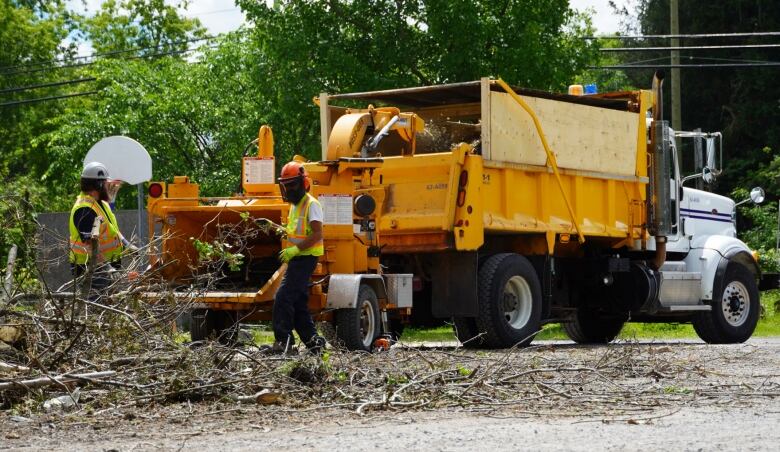
Cleanup operations
City crews havebeen making special trips to collecttree and shrubdebris from curbssince the storm, but will stopon June 24.
After Friday, any remainingdebris will have to be properly cut up, bundled orbagged to conform to regular weekly leaf and yard waste collection standards.
Tree removal permits are not required to remove storm-damaged trees that pose an immediate threat to health and safety, according to the city, but photos should be taken ahead of removal to prove removal was required. The same goes for treesdamaged to the point that they won't survive.
Residents needingstumps removed fromtheir property areasked to be patient as the city comes up with a plan to perform that work over the summer months.
A total of 528 city parks suffered tree damage in the derecho.As of June 9, cleanup was still needed in 272 of them, the city said.
Much remains closed due to fallen trees on NCC-controlled lands in OttawaincludingMcCarthy Woods, Mer Bleue, Green's Creek, Pine Grove, Southern Farm and Pinhey Forest, Stony Swamp, Conroy Pit off-leash dog park, and the dense forest in Bruce Pit off-leash dog park.
Interested in learning more about the region's tree cover?
This is Ottawa'sinventory map of city-owned trees(note: the data can take some timeto load). It was first published in 2018 and last updated in February 2021. At that time there were nearly 281,000 trees logged.
Residents maywantto update the city about any destroyedcity-owned trees on their property after the storm. The city says you can report changes to the tree inventoryby calling 311.
This is thecity's urban forest management plan, which is guidingtree canopy protection and expansioneffortsuntil 2037.
And this is the report stemming fromthelast major canopy assessmentfor the National Capital Region.


_(720p).jpg)


 OFFICIAL HD MUSIC VIDEO.jpg)
.jpg)


