Massive winter storm hitting eastern Ontario
Snowfall could be up to 35 cm
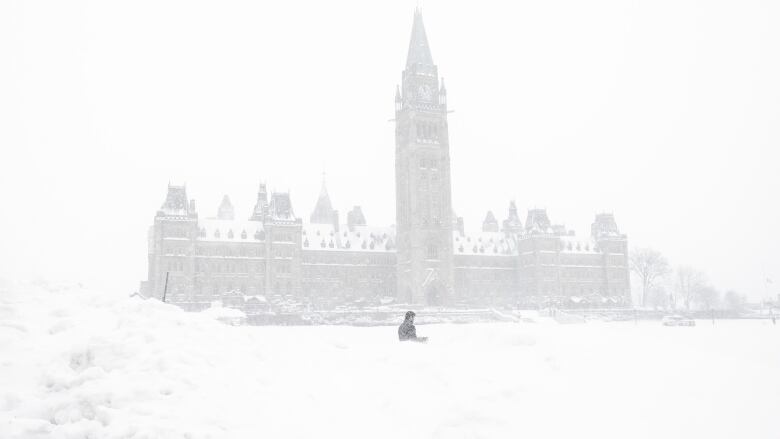
Brace yourselves. What's likely the biggest snowstorm in years has reached our area.
It's a Colorado Low, which normallygives us 10 to 15 centimetresof snow here in Ottawa, so why 25to 35centimetres in the forecast?
Simply put, this is a stronger than normal lowand the track of the storm is putting the maximum snow shield right on top of us.
Light snow started in Ottawa around 4 p.m. with the worst part of the storm coming this evening. It will continue into early Wednesday, when the snow will be at its heaviest and the wind will be at its strongest with gusts up to 60 km/h.
In the Kingston area, snow has been falling since early this morning.
A winter storm warning is in place for the entire region and travel in this period is not advised.
Schools across Ottawa are cancelled for Wednesday and many federal workers are being encouraged to work from home
Overnight parking bans are in place and public meetings are also postponed.
- Incoming blizzard cancels parking, classes, waste pickup, meetings
- Schools closed, buses cancelled ahead of major snowstorm
It's still dangerously cold aswell, with a wind chill around the frostbite advisory threshold of25 most of the day.
Follow along with the latest on Twitter.


_(720p).jpg)


 OFFICIAL HD MUSIC VIDEO.jpg)
.jpg)


