Huge snow dump coming to Sask. this weekend
The heaviest snow will arrive on Sunday afternoon into Monday morning.
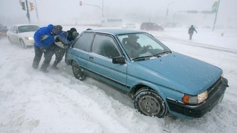
After a week of high temperatures breaking records thanks to a warm front bringing temps into the low 20s, people in Saskatchewan arenow preparing to trade in their sandals for snowshoes.
The recent beautiful weather will play a role in the upcoming weekend winter event. The warm air coupled with arctic air being pushed in and a deepeninglow pressure system state-side could be a recipe for record-breaking snow in the province.
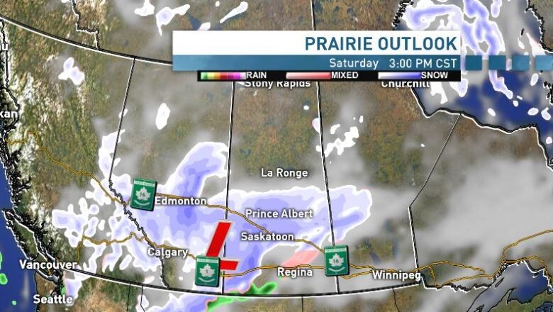
Starting late on Friday, a low pressure system will beginmovingacross the the central grainbelt, bringing a mix of snow and freezing rain, and potentially ice pellets. As this system moves from the south west corner quickly north,areas like Saskatoon will experience potentially hazardous roads conditions due to both ice and reduced visibility.
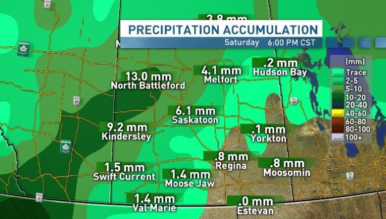
Only about one cm of snow and about one mm of rain are expected Friday, but on SaturdaySaskatoon will see a deepening upper-level trough, bringing a dramaticchange in temperaturesand much more intense snow.
Saskatoon, Prince Albert andNorth Battlefordshould expect 10 cm of snow Saturday, but areas like Swift Current will see around five cm and Regina should expect about one cm (with one mm of freezing rain mixed in).
The big show
Things should changefor the worse on Sunday. Snowfall rates will start to rapidly intensify across southern areas and the wind will increase from the north east, at 35 km/hr gusting to 55. Visibility will decrease quickly.
This scenario is a classic Colorado low, as it will bring intense snow and will move quickly, slicing theprovince on a northeast angle. This storm also has the potential to become a blizzard and close highways, including the TransCanada.
"Regina is flirting with freezing rain at first, but 30 cm looks possible with the heaviest snow coming Sunday evening and overnight,"Terri Lang with Environment and Climate Change Canada said.
"Many places in Sask. will likely get over 30 cm of snow, with snow and blowing snow a big issue well into Monday. Freezing rain is a real threat in the southeast."
Blowing and drifting snow and whiteout conditions are possible and people should only travel after consulting the Saskatchewan Highways Hotline.The storm is anticipated to hit its peakSunday night.
The bullseye of the storm is settling over Moose Jaw, where snowfall could be between 40 and 50 cm on Sunday.The previous record for that date in Moose Jaw was set in 1995with 10.7 cm.
Regina could see 30 to 40 cmfrom Sunday night into Monday morning. Saskatoon could see approximately 25 centimetres on Sunday, making for a weekend total of as much as 35 centimetres by the time the storm passes.
Daytime highs will be below freezing on Saturday and Sunday, creating an increased risk of highways freezing over and creating unfavourable driving conditions.
Travellers in thesoutheast corner of the province should be cautious over the weekend, as the storm will transition to mostly freezing rain and ice pellets. This will also be a major concern for commuting.
By Monday the system should startto weaken and move onto Manitoba. Looking at the week ahead, temperatures return to seasonal and overnight lows will be below season at -19 C on Monday into Tuesday.


_(720p).jpg)


 OFFICIAL HD MUSIC VIDEO.jpg)
.jpg)


