Satellite shows giant smoke plumes from Sask., Alberta forest fires
Satellite images of the forest fires in northern Alberta and Saskatchewan show the extent of the wildfires that have displaced thousands of people this week.
NASA image shows extent of western Canadian wildfires
Satellite images of the forest fires in northern Alberta and Saskatchewan have shown the extent of the wildfires that have displaced thousands of people this week.
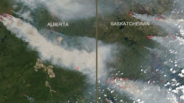
The National Aeronautics and Space Administration's Aqua satelliteshowed plumes of smoke stretching from multiple pointshundreds ofkilometres to the southeast.
Actively burning areasare outlined in red, while forests appear dark green.
Smoke has been raising health concerns in Regina and other communities that are hundreds of kilometres south of the fires. People with asthma or heart conditions have been advised to stay indoors.
There were 115 fires burning in Saskatchewan on Monday. Interview with Larry Rosia, president of Saskatchewan Polytechnic, which is housing over 100 fire evacuees at its Prince Albert location


_(720p).jpg)


 OFFICIAL HD MUSIC VIDEO.jpg)
.jpg)


