Timelapse shows dramatic water rise at Quill Lakes
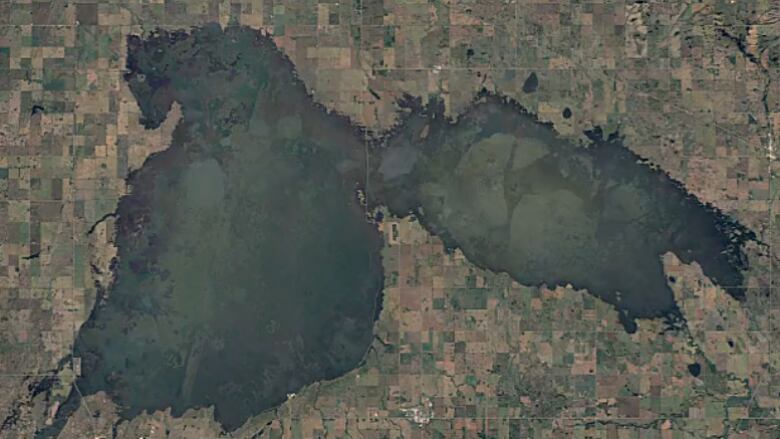
Satellite images show the dramatic water level rise of a set of lakes in east-central Saskatchewan.
Water Security Agency began enforcing new drainage regulations this summer
Satellite images show the dramatic water level rise of a set of lakes in east-central Saskatchewan.
Stretching back to 1984, the Google Earth Engine page shows how high water levels caused the two Quill Lakes to merge, starting in 2012. The water remains high.
Heavy rainfall over the past several years has soaked the area, causing local farmland to flood and roads to be washed out.
This summer, the Water Security Agency announced it will be enforcing new drainage regulations to stop the lake's water from rising further.
Landowners were given until Oct. 1of this year to stop all projects that drain into the lake.


_(720p).jpg)


 OFFICIAL HD MUSIC VIDEO.jpg)
.jpg)


