Climate change as seen from space: Bob McDonald
Satellite data from NASA illustrates increasing carbon dioxide levels in our atmosphere
A new supercomputer visualization from NASAprovides an astounding 3D view of carbon dioxide spreading around the globe over a year. Based on actual satellite data, this is one of many tools that are documenting the changing face of our warming planet as seen from the ultimate high perspective.
The satellite that provided this perspective, called OCO-2 (Orbiting Carbon Observatory), was launched in 2014 with the sole purpose of identifying both natural and artificial sources of carbon dioxide and how the gas circulates globally on weather systems. It shows naturalsources from wildfires in South America and Africa during summer, then industrial sources in the U.S., Europe and China take over. The carbon dioxide accumulates mostly in the northern hemispherebecause that's where most of it originates, and is then driven into the Arctic regions, producing the fastest-warming trends and most dramatic changes anywhere on Earth.
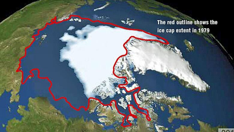
We tend to forget about the fleet of satellites that have been orbiting Earth for decades, tracking the changes taking place as a result of human activity and climate change. Their accumulated data show, on a planetary scale, how sea ice has disappeared in the north, how the atmosphere has warmed, and the future impact of rising sea levels.
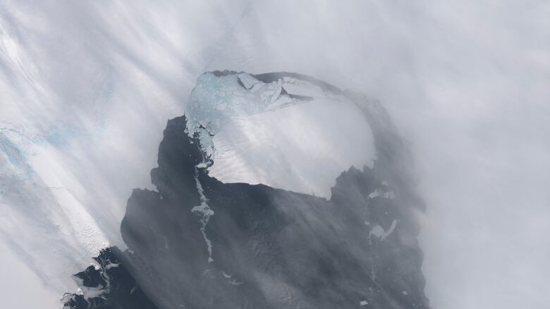
Comparing historic images of specific regions with current views show the growth of cities, retreating glaciers, floods, droughts, forest fires just about every aspect of our constantly changing environment.
Robotic spacecraft that journey to other planets get a lot of attentionas they reveal alien desert landscapes on Mars, gigantic storms on Jupiter, the magnificent rings of Saturn or the strange icy terrain of Pluto.We think of those other worlds as planets, each one distinct from the other. But Earth is a planet too, and satellites that point their instruments down are providing us with a planetary perspective, which is often lost among our daily concerns with economies, conflicts and other tightly focused human needs.
Environmentalists are concerned about the incoming administration of president-elect Donald Trump. He's called climate change a hoax and has nominated the CEO of the ExxonMobil Corporation for Secretary of State. They worry fossil fuel extraction will be more important than fighting climate change.
It would be a good idea for anyone who believes there is no evidence ofclimate change to have a look at the records NASA has released and to see the changes for themselves. Satellites don't lie.


_(720p).jpg)


 OFFICIAL HD MUSIC VIDEO.jpg)
.jpg)


