How hurricanes generate deadly storm surges and catastrophic floods
Hurricane-force winds can drastically change shorelines by pushing water toward or away from shore
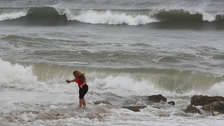
The U.S. National Hurricane Center forecasts "life-threatening" storm surge along the coasts of Florida, Georgia and the Carolinas from Hurricane Dorian the second most-powerful Atlantic storm ever recorded.
Here are the #Dorian Key Messages for Sept 3rd 11 AM EDT: Many new #Hurricane Watches and Warnings have been issued for the Carolinas with multiple threats expected across the southeastern United States. More: https://t.co/tW4KeGdBFb pic.twitter.com/LepqRE983a
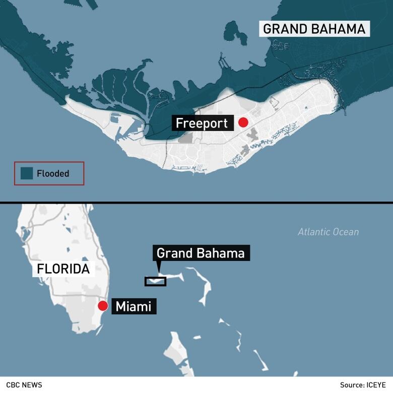
—@NHC_AtlanticAs of Tuesday, Dorian's"catastrophic" storm surgehad already submerged much of Grand Bahama island in up to seven metres of water, killing five people.
The choppy brown floodwaters rose to the second storey of some buildings and near the tops of palm trees, forcing people to scramble onto rooftops to escape.
The airport was under two metres of water, the main hospital was unusable due to massive flooding, and even two designated storm shelters had flooded.
Storm surge is the name given to huge wavesshoved toward the shore and sometimes far inland by a hurricane's powerful winds.
The winds push the water down, but as the huge volumes of waterreachthe shallows nearthe shore, they're forced up onto the land, causing floods.
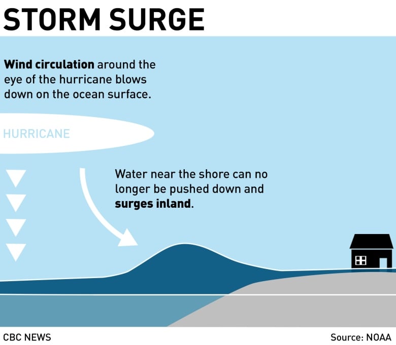
The impact of the storm surge depends on the speed of the wind, how low the pressure is in the eye of the storm and the shape of the coast,said ChrisFogarty, senior research meteorologist at the Canadian Hurricane Centre.
Harbours and bays are particularly affected by storm surgebecause water is funnelled into one place and pushed, which amplifieswhat happens to the water.
Because wind speeds vary depending on the part of the hurricane that hits a particular location, a small change in the hurricane's predicted path can cause a big change in the storm surge.
All these factors can make it difficult to predict how much storm surge will happen during a hurricane, Fogarty said.
That's why it may end up being much bigger or smaller than predicted.
Negative storm surge
There's also a strange phenomenon known as negative storm surge. During Hurricane Irma in 2017, that's what dried out areas of the shorelinein Florida that are normally submerged, leavingsome manatees stranded.
Manatee stranded by #Irma People coming to the rescue when the waters receded in Sarasota. @ActionNewsJax #HurrcaneIrma pic.twitter.com/UTcUiH3wl3
—@PaigeANjaxThey were also an odd sight for residents used to water levels thatdon't deviate very much when the tide goes in or out,
"It's wind pushing that water away," Fogartysaid."When wind is blowing off shore, you don't have the big waves at the beach because the wind is in the opposite direction."
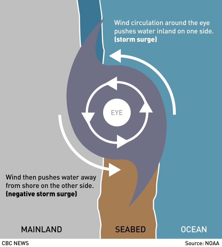
On a smaller scale, Fogarty said you could watch how water in a puddle reacts to winds. Wind creates ripples based on the direction of the wind, which is essentially what happens in storm surge.
"It's all about wind direction," he said.
"The strong wind shift blowing from one direction and then in the total opposite direction after the eye goes through ... pushes that same water right back in quite quickly behind the eye of the storm."
The water often returns very quickly. After a negative surge from Irma, more than 1.5 metres of water returned to one coast in less than an hour, he said.
"If you see water get drawn out, it doesn't mean to go out and explore," Fogarty said. "It means something weird's going on. You don't want to be caught with the water coming back in."
With files from Emily Chung


_(720p).jpg)


 OFFICIAL HD MUSIC VIDEO.jpg)
.jpg)


