Your smartphone might help you build a better city
Cycling apps help cities figure out what routes riders are taking

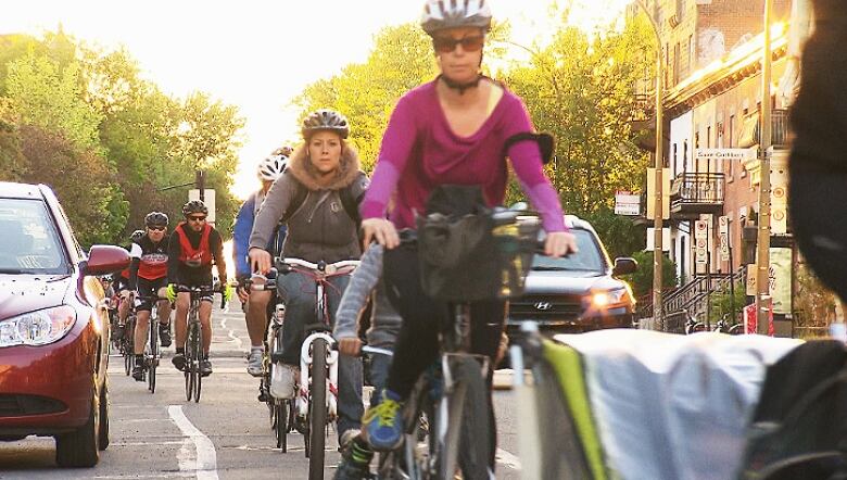
With cycling season in full swing, Toronto streets are teeming with riders commuting or simply out enjoying a spin.
Over 4,000 of them have signed up for Toronto Cycling, a mobile app that uses your smartphone's on-board GPS and a bit of voluntary personal information to map your route and provide an overview of distance, speed and trip time, even the number of calories you burned.
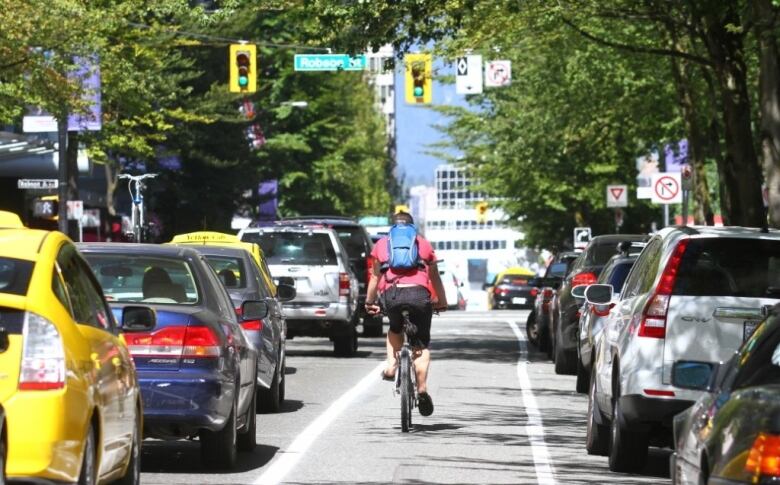
- Biking in Vancouver ranks 46th on list of 122 bike-friendly cities worldwide
- Cycling safety: Too often, bikes still ignored on Canadian roads
The City of Toronto offers the app for free, but the municipality is hoping for something in return namely, that you upload the data about each trip to its server, which could help the city make future decisions about where to build new bike lanes.
"We wanted to use an app to understand cyclists' route choice," says Jacquelyn Hayward Gulati, the City of Toronto's manager of Cycling Infrastructure and Programs.
Hayward Gulati says the city has already received over 70,000 trips, and that the data gathered from the app will feed into a study on how to improve the city's biking network.
Toronto Cycling is not the only app that allows you to document your two-wheeled travels, but it's part of a growing trend in which cities from London to Singapore to Portland, Ore. take advantage of smartphone technology to gain a better picture of how people are travelling on non-motorized modes of transport.
The collection of this data has the potential to make travelling in cities safer and more efficient, says Diego Canales, who studies transportation demand for the World Resource Institute in Washington, D.C.
Gathering better data
The Toronto Cycling app, which is available for the Apple and Android operating systems, only works if you activate geo-location services on your phone. When you load the app, it shows your location on a map.
When you're ready to start your trip, you press a large button on the screen; when you've reached your destination, you hit it again. At that point, the app illustrates your route and asks you whether you want to upload it to the City of Toronto server.
The city says any information gleaned about you from the app will not be shared with third parties.
That included telephone surveys, which would give information about origins and destinations, but not detailed information about routes. Transportation planners use computer algorithms to try and predict the routes that people will take, but Patterson says these algorithms rely on hypotheses and assumptions about how people choose their routes rather than on precise geographical data.
For several years now, Patterson and his team of researchers at Concordia's Transportation Research for Integrated Planning (TRIP) Lab have been trying to gather more detailed "origin-destination" data.
In the fall of 2014, the lab released DataMobile, an app intended to capture data about travel patterns of students and staff at Concordia.
Between Nov. 10 and Dec. 5, 2014, close to 1,000 people participated in the pilot project. The collected data, which is currently being studied, is stored on a secure server that belongs to the TRIP Lab.
Patterson hopes that its findings can someday be used to inform decisions about transportation planning in Montreal.
In the meantime, the team's app is also being used to map bus routes in Accra, the capital of the West African nation of Ghana.
The Accra Department of Transport regulates where buses start and stop, "but they don't regulate what routes they take, so we're mapping that out with DataMobile," says Patterson.
Started in San Francisco
This type of data collection is spreading around the world, but it got its start in San Francisco, says Canales.
Back in 2009, the city, in conjunction with the San Francisco Municipal Transportation Agency, developed Cycletracks, an open-source app that allowed riders to use their smartphones to report their rides.
The idea caught on across North America, with cities such as Austin, Tex., Raleigh, N.C. and Seattle using Cycletracks' source code to create their own apps. The Toronto Cycling app is built on the same code.
Canales says that a running and cycling app called Strava, which was incidentally also built in San Francisco, does something similar, but that it was privately developed and is not open source.
The company is sharing its data with municipalities, but for a price Canales says Oregon's Department of Transportation paid Strava $20,000 US for a year's worth of data, which covers about 17,700 riders and 400,000 individual trips, according to BikePortland.org.
While this type of data collection is still in its infancy, Canales says it will enable civic policy makers to make better decisions about urban planning.
"Before, [the attitude] was build it, and let them come," says Canales. But that attitude put an emphasis on the supply side of the equation, and led to the development of a lot of infrastructure that wasn't being used.
This newer, crowd-sourced data is better informing the decision-making by looking more closely at the demand, says Canales.
Thanks to this data, "we know that most cyclists are riding on [certain] streets, even though there's no infrastructure, so it makes sense to put infrastructure there," Canales says.
The data collected through smartphones is "pairing up the demand with the supply."


_(720p).jpg)


 OFFICIAL HD MUSIC VIDEO.jpg)
.jpg)


